To give you guys an idea on this.
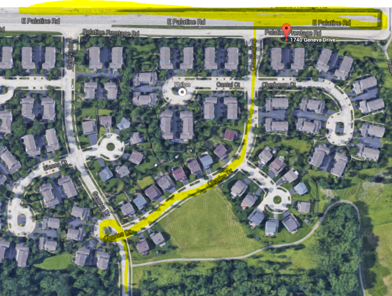
The first image below is right over my house. The highlighted area is where this a-hole drove from, drifted around to proceed through Charles to Palatine.
This next picture is as follows: Red open circle is the shop's location. They can proceed north to travel through the subdivision by turning left at the first highlighted area. Or, they can turn right over the tracks to Wolf Road, then turn left and drive about 2 blocks to get to Palatine Road. The highlighted areas are stop signs and the red lines are stop lights depending on the route they take.
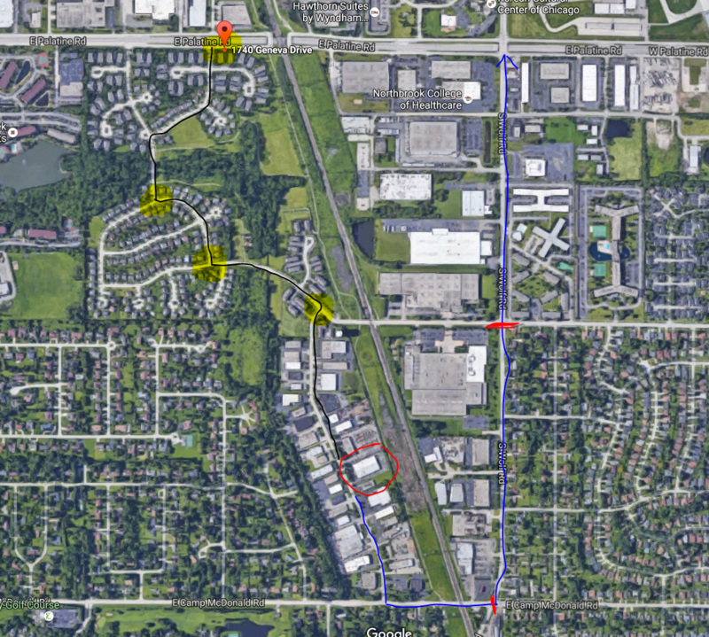
Makes no sense distance wise or time-wise to go through the subdivision.


Waze took me down your street the other day avoiding Hintz, Dundee, and Euclid traffic


 I love when people stop in the road in front of my house and do burnouts!:luda: